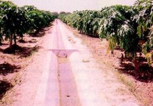
Irrigation Facilities for Riverine Area Sindh
BACK TO PROJECTS

Project Description
The study was concerned with the riverine areas of the River Indus between Guddu Barrage and the Sea. The main objective of the study was to identify the scope for agricultural and forestry development within the riverine areas without adversely affecting the environment and using only local water resources, particularly ground water.
Services
-
Satellite imagery interpretation with the MIPS image processing system and study of past land use and soil surveys allowed for mapping of land suitability for agriculture and forest development
-
Hydrological studies were undertaken to evaluate the potential of flood waters recharging the riverine areas
-
Surface water and groundwater modelling were used to identify water resources available within the riverine areas, and to assess the impact of lowering of river levels and ground water abstraction on saline intrusion and on agricultural land adjacent to the riverine areas


